Description
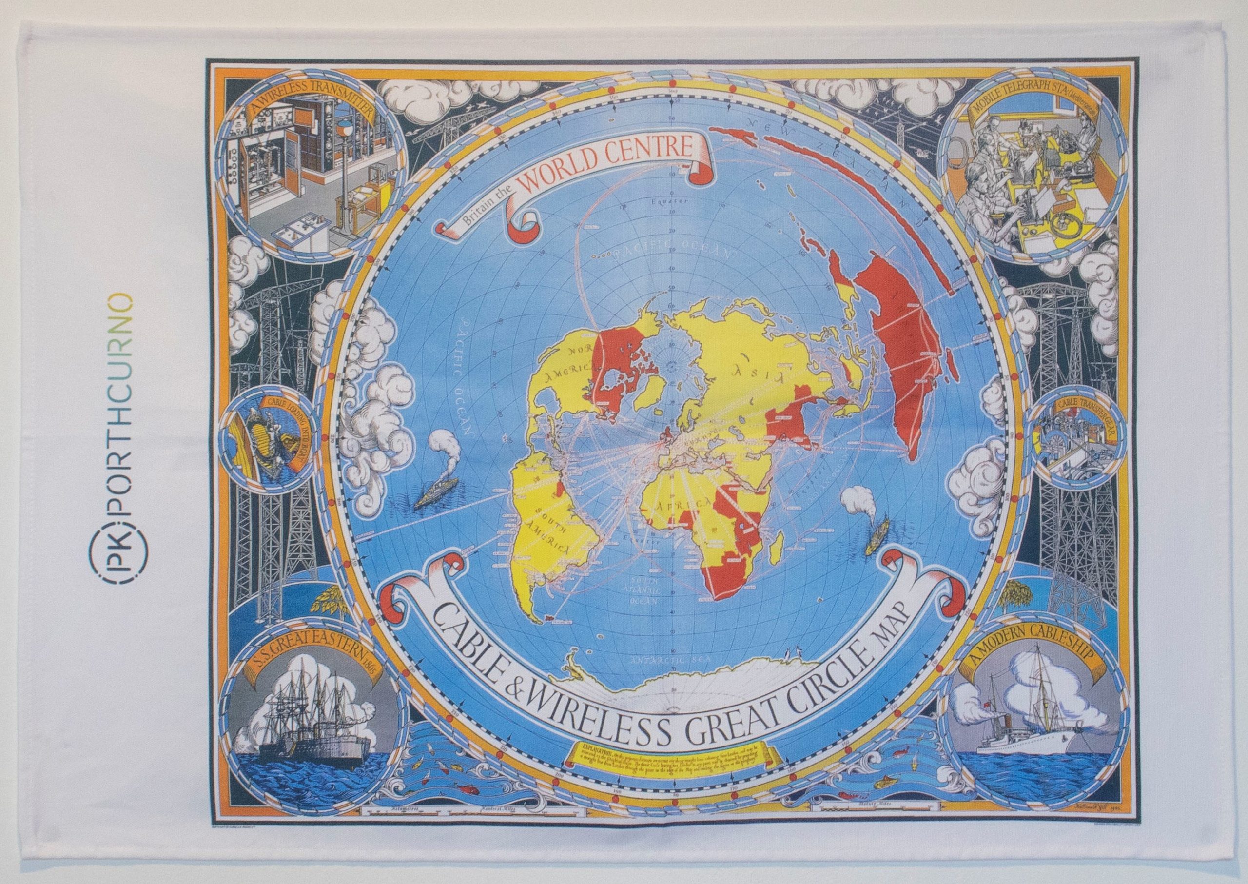
Tea Towel – Great Circle Map
Displaying the iconic Great Circle Map in full colour detail, this quality tea towel is 100% cotton.
Created by Macdonald Gill, The Great Circle Map dates from 1945. The map shows the British Empire’s telegraph cable and wireless networks around the world at the time. The red lines represent telegraph cables and the dashed lines are radio links.
Printed in Cornwall by Lorna Wiles Textiles, using non-toxic water-based inks.
Dimensions: 70cm x 47cm
Tea Towel – Great Circle Map